
United Kingdom Statutory Instruments
You are here: BAILII >> Databases >> United Kingdom Statutory Instruments >> The Antarctic (Amendment) Regulations 2008 No. 3066
URL: http://www.bailii.org/uk/legis/num_reg/2008/uksi_20083066_en_1.html
 |
[Home] [Databases] [World Law] [Multidatabase Search] [Help] [Feedback] [DONATE] | |
United Kingdom Statutory Instruments |
||
|
You are here: BAILII >> Databases >> United Kingdom Statutory Instruments >> The Antarctic (Amendment) Regulations 2008 No. 3066 URL: http://www.bailii.org/uk/legis/num_reg/2008/uksi_20083066_en_1.html |
||
[New search] [Help]
Made
19th November 2008
Laid before Parliament
8th December 2008
Coming into force
29th December 2008
The Secretary of State for Foreign and Commonwealth Affairs makes the following Regulations in exercise of the powers conferred by sections 9(1), 10(1), 14(1), 25(1) and (3) and 32 of the Antarctic Act 1994(1):
1. These Regulations may be cited as the Antarctic (Amendment) Regulations 2008 and shall come into force on 29th December 2008. The Antarctic Regulations 1995(2) ("the principal Regulations"), as amended(3), and these Regulations may be cited together as the Antarctic Regulations 1995 to 2008.
2. Regulation 4(2) of the principal Regulations shall be deleted and replaced by the following:
"(2) No later than 10 days after receiving the application, the Secretary of State shall cause notice of the application to be published on the internet website of the Foreign and Commonwealth Office in such form and containing such information as he may deem appropriate which shall include the name and contact details of the applicant."
3. Regulation 6(5) of the principal Regulations shall be amended by substituting for the words
"in the London Gazette" the words "on the internet website of the Foreign and Commonwealth Office".
4. The Schedules to the principal Regulations shall be amended as follows:
(a) There shall be deleted from Schedule 1 the area listed as ASPA 129: Rothera Point.
(b) There shall be added to Schedule 1 the areas listed and described in Schedule 1 to these Regulations.
(c) There shall be deleted from Schedule 2 the Historic Sites and Monuments listed and described as: "Site No 12 Cross and Plaque at Cape Denison, George V Land" and "Site No 13 Hut at Cape Denison, George V Land".
(d) There shall be added to Schedule 2 the Historic Sites and Monuments listed in Schedule 2 to these Regulations.
Gillian Merron
For the Secretary of State
for Foreign and Commonwealth Affairs
19th November 2008
Regulation 4(b)
| RESTRICTED AREAS |
| Antarctic Specially Protected Area No. 109 |
| Moe Island, South Orkney Islands |
| Lat: 60°44-�S; Long: 45°41-�E |
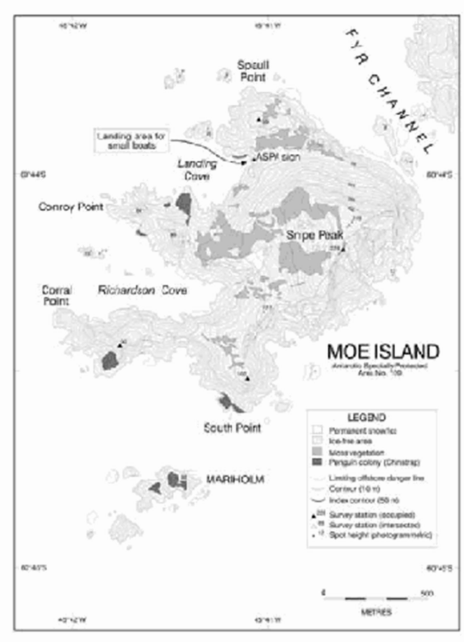
Moe Island is a small irregularly-shaped island lying 300 metres off the south-western extremity of Signy Island from which it is separated by the Fyr Channel. Moe Island is approximately 1.3 kilometres from northeast to southwest and 1km from northwest to southeast.
Map: ASPA No. 109: Moe Island
Map specifications: Projection: WGS84 Antarctic Polar Stereographic. Standard parallel: 71°S. Central meridian 45°W.
 View a larger version of this image
| RESTRICTED AREAS |
| Antarctic Specially Protected Area No. 113 |
| Litchfield Island, Arthur Harbour, Anvers Island, Palmer Archipelago |
| Lat: 64°46-�S; Long: 64°05-� W |
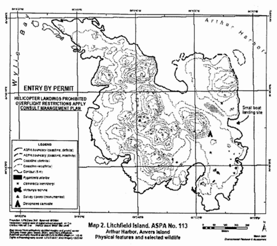
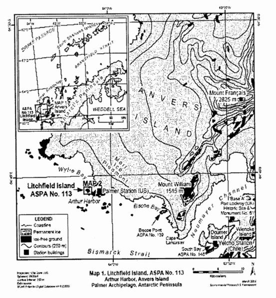
Litchfield Island (0.35 square kilometres) is situated in Arthur Harbour approximately 1500 metres west of Palmer Station (United States). The island measures approximately 1000 metres northwest to southeast and 700 metres from northeast to southwest. It has the most varied topography and greatest diversity of terrestrial habitats of the islands in Arthur Harbour. The area is defined as all of Litchfield Island above the low tide water level excluding all offshore islets and rocks. No boundary markers have been installed as the coast is clearly defined and is a visually obvious boundary feature.
Map 1: ASPA No. 113: Litchfield Island
 View a larger version of this image
Map 2: ASPA No. 113 Litchfield Island
 View a larger version of this image
| RESTRICTED AREAS |
| Antarctic Specially Protected Area No. 116 |
| New College Valley, Caughley Beach, Cape Bird, Ross Island |
| Lat: 77°13-�S; Long: 166°26-�30-�E |
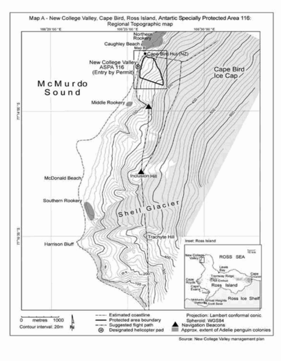
New College Valley is located south of Cape Bird on ice-free slopes above Caughley Beach which lies between the Cape Bird Northern and Middle Rookeries. The boundaries of the area follow the ridges enclosing the catchment of the New College Valley.
Map 1: ASPA 116: New College Valley
 View a larger version of this image
Map 2: ASPA No. 116: New College Valley
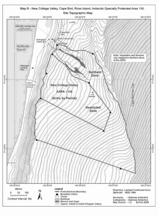 View a larger version of this image
| RESTRICTED AREAS |
| Antarctic Specially Protected Area No. 119 |
| Davis Valley and Forlidas Pond, Dufek Massif, Pensacola Mountains |
| Lat: 82°27-�S; Long: 51°05-�W (Davis Valley) |
| Lat: 82°27-�S; Long: 51°16-�W (Forlidas Pool) |
The Area comprises all of the Davis Valley and includes the entire ice-free region centred on the Valley, including the immediately adjacent ice-free valleys and Floridas Pond and encompasses a total area of 57.2 square kilometres. Boundary markers have not been installed but the boundary predominantly follows the margins of the surrounding ice fields of the Ford Ice Piedmont and Sallee Snowfield.
Map: ASPA No. 119: Davis Valley and Floridas Pond
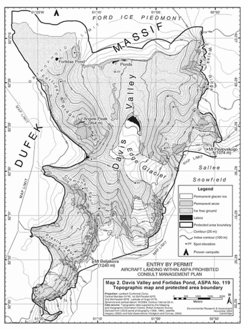 View a larger version of this image
| RESTRICTED AREAS |
| Antarctic Specially Protected Area No. 122 |
| Arrival Heights, Hut Point Peninsula, Ross Island |
| Lat: 77°49-�S; Long: 166°40-� E |
Arrival Heights is a small range of low hills near the southeast end of Hut Point Peninsula, South East Ross Island, 1.5 kilometres north of McMurdo Station and 3 kilometres north of Scott Base. It is formed by a line of craters that extend south from the flanks of Mount Erebus. The highest elevation within the Area is Second Crater at 255 metres, one of two inactive volcanoes that are a part of the boundaries of the Area. The boundaries of the Area extend in a straight line from Trig T510 Northwest over First Crater to the 150 metre contour. The boundary extends east to Second Crater, the lip of which forms the northeast corner of the area. The boundary then extends south in a straight line to Trig T510.
Map: ASPA No. 122: Arrival Heights
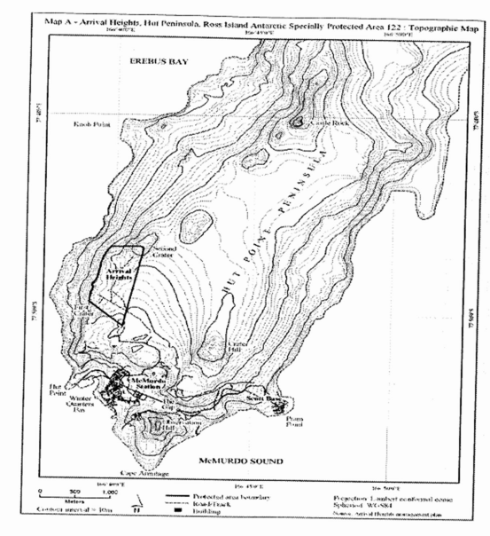 View a larger version of this image
| RESTRICTED AREAS |
| Antarctic Specially Protected Area No. 127 |
| Haswell Island (and Adjacent Emperor Penguin Rookery on Fast Ice), David Sea |
| Lat: 66°31-�S; Long: 93°00-�E |
The Area consists of Haswell Island (approximately 1 square kilometre) and its littoral zone and the adjacent section of fast ice in the Davis Sea (the fast ice is approximately 5 square kilometres when present). This is a unique breeding site for almost all breeding bird species in East Antarctica.
Map: ASPA No. 127: Haswell Island
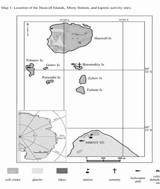 View a larger version of this image
| RESTRICTED AREAS |
| Antarctic Specially Protected Area No. 129 |
| Rothera Point, Adelaide Island |
| Lat: 67°34-�S; Long: 68°08-�W |
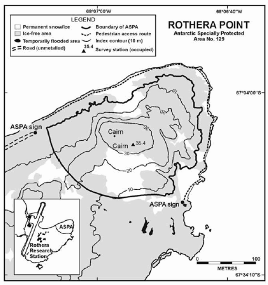
Rothera Point is situated in Ryder Bay at the south-east corner of Wright Peninsula on the east side of Adelaide Island south-west Antarctic Peninsula.
The Area is the northern one-third of Rothera Point extending approximately 280 metres from west to east and 230 metres from north to south, rising to a maximum height of 36 metres. At the coast the boundary is the 5 metre contour (formerly the 2.5 metre contour). The Area does not include any upper shore, littoral or sub-littoral areas of Rothera Point. The southern boundary of the Area runs across Rothera Point and is partially marked by rock filled gabions. Rothera Research Station (United Kingdom) lies approximately 250 metres west of the western boundary.
Map: ASPA No. 129: Rothera Point
Map specifications: Projection: WGS84 Antarctic Polar Stereographic. Standard parallel: 71°S. Central meridian 67°45-�W.
 View a larger version of this image
| RESTRICTED AREAS |
| Antarctic Specially Protected Area No. 131 |
| Canada Glacier, Lake Fryxell, Taylor Valley, Victoria Land |
| Lat: 77°37-�S; Long: 163°03-�E |
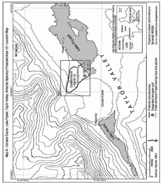
Canada Glacier is situated in the Taylor Valley, in the southern Victoria Land Dry Valleys. The Area encompasses most of the glacier forefield area on the east side of the lower Canada Glacier, on the north shore of Lake Fryxell. It contains some of the richest plant growth (bryophytes and algae) in the southern Victoria Land Dry Valleys.
Map: ASPA No. 131: Canada Glacier
 View a larger version of this image
| RESTRICTED AREAS |
| Antarctic Specially Protected Area No. 134 |
| Cierva Point and Offshore Islands, Danco coast, Antarctic Peninsula |
| Lat: 64°09-�S; Long: 60°57-�W |
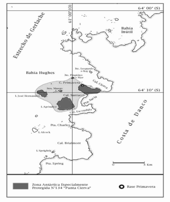
Cierva Point was designated on the basis of its well developed maritime vegetation and breeding colonies of a variety of bird species. It is located in the south coast of Cierva Cove to the north of Hughes Bay. The site comprises the ice-free area between the southwest coast of Cierva Cove and the northeast coast of Santucci Cove and also includes Apendice and Jose Hernandez Islands and the Moss and Penguin Islands. The inter-tidal zone of these areas is also included but not the sub-tidal marine environment.
Map: ASPA No. 134: Cierva Point
 View a larger version of this image
| RESTRICTED AREAS |
| Antarctic Specially Protected Area No. 139 |
| Biscoe Point, Anvers Island, Palmer Archipelago |
| Lat: 64°48-�S; Long: 63°47-� W |
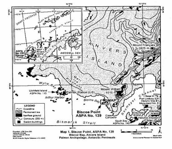
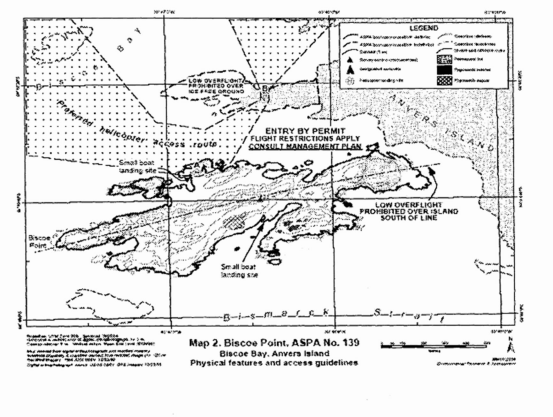
Bisco Point is at the western extremity of a small island located close to the southern coast of Anvers Island approximately 6 kilometres south of Mount William. This island is separated from Anvers Island by a 50 metre wide permanent marine channel. The Area is defined to include all land above the low tide water level of the main island on which Biscoe Point is situated (0.53 square kilometres), all offshore islets and rockets within 100 metres of the shore of this main island and most of the predominantly ice-free promontory 300 metres to the north (0.1 square kilometre).
Map 1: ASPA No. 139: Biscoe Point
 View a larger version of this image
Map 2: ASPA No. 139: Biscoe Point
 View a larger version of this image
| RESTRICTED AREAS |
| Antarctic Specially Protected Area No. 140 |
| Parts of Deception Island, South Shetland Islands |
| Lat: 62°57-�S; Long: 60°38-�W |
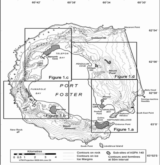
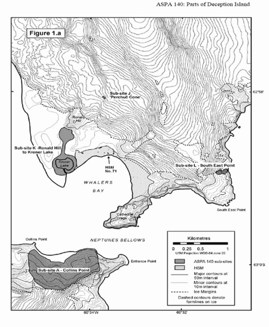
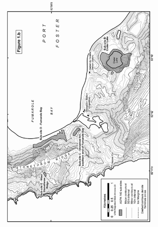
Deception Island, situated in the Bransfield Strait, is a unique Antarctic island with important natural, scientific, historic, educational and wilderness value. The Area comprises 11 terrestrial sub-sites namely Collins Point; Crater Lake; Unnamed hill at the southern end of Fumarole Bay; Fumarole Bay, West Stonethrow Ridge; Telefon Bay, Pendalum Cove; Mount Pond; Perchue Cone; Ronald Hill to Kroner Lake; and South East Point.
Map 1: ASPA No. 140: Parts of Deception Island
 View a larger version of this image
Map 2: ASPA No. 140: Parts of Deception Island
 View a larger version of this image
Map 3: ASPA No. 140: Parts of Deception Island
 View a larger version of this image
Map 4: ASPA No. 140: Parts of Deception Island
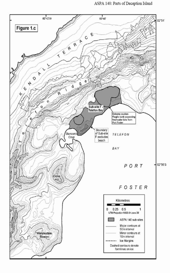 View a larger version of this image
Map 5: ASPA No. 140: Parts of Deception Island
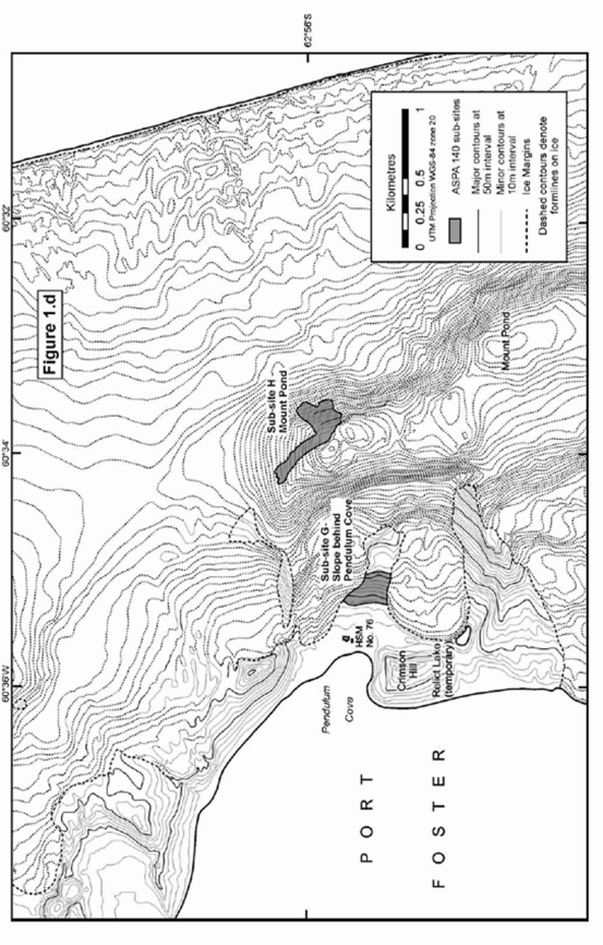 View a larger version of this image
| RESTRICTED AREAS |
| Antarctic Specially Protected Area No. 142 |
| Svarthamaren, Mühlig-Hoffmannfjella, Dronning Maud Land |
| Lat: 71°55-�S; Long: 5°15-�E |
The Area covers approximately 6.4 square kilometres and consists of the ice-free areas of the Svarthamaren nunatak, including the rocks in the immediate vicinity. The Norwegian field station Tor is located in the Svarthamaren nunatak but it, and a 10 metre buffer zone around the station buildings, is excluded from the Area.
Map: ASPA No. 142: Svarthamaren
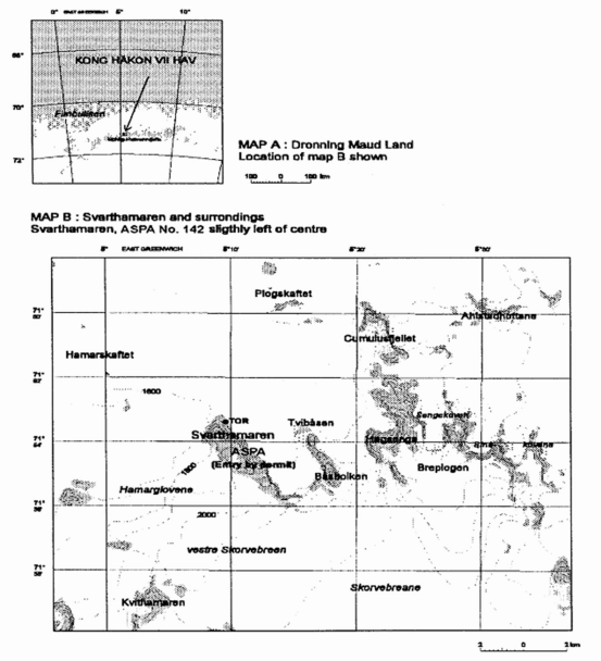 View a larger version of this image
| RESTRICTED AREAS |
| Antarctic Specially Protected Area No. 145 |
| Port Foster, Deception Island, South Shetland Islands |
| Lat: 62°57-�S; Long: 60°38-�W |
The Area comprises two main sites (sub-sites A and B) within Port Foster.
Benthic habitat A: between 50 and 150m depths and the coordinates: lat 62°55.5-�S long 60°38-�00-�W, lat 62°56.2-�S long 60°37-�00-�W.
Benthic habitat B: between 100 and 150m depths and the coordinates: lat 62°57.2-�S long 60°37-�20-�W, lat 62°57.9-�S long 60°36-�20-�W.
Map ASPA No. 145: Port Foster
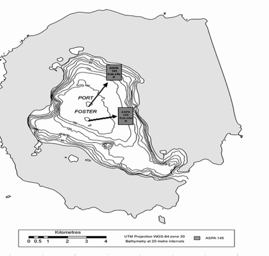 View a larger version of this image
| RESTRICTED AREAS |
| Antarctic Specially Protected Area No. 149 |
| Cape Shirreff and San Telmo Island, Livingston Island, South Shetland Islands |
| Lat: 62°27-�S; Long: 60°47-�W |
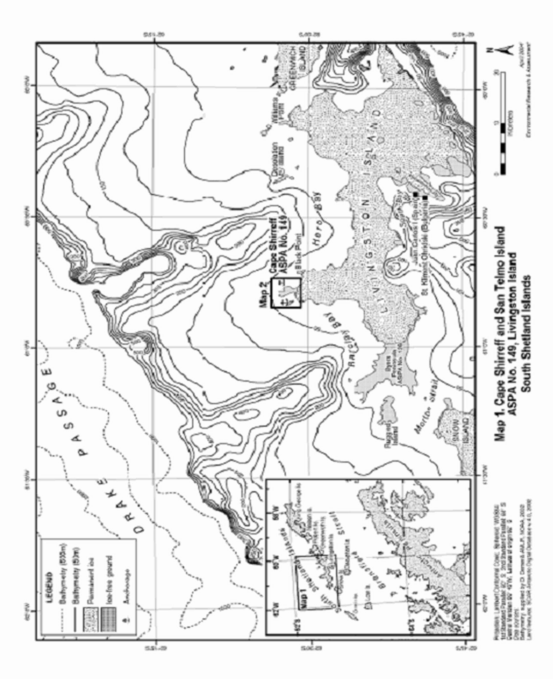
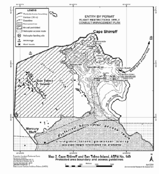
Cape Shirreff is situated on the northern coast of Livingston Island. The Area (9.7 square kilometres) comprises the entire Cape Shirreff peninsula north of the permanent Livingston Island ice cap, the San Telmo Island group and the surrounding and intervening marine area. The marine boundary encloses an area that extends 100 metres from, and parallel to, the outer coastline of the Cape Shirreff peninsula and the San Telmo island group.
Map 1: ASPA No. 149: Cape Shirreff and San Telmo Island
 View a larger version of this image
Map 2:ASPA 149: Cape Shirreff and San Telmo Island
 View a larger version of this image
| RESTRICTED AREAS |
| Antarctic Specially Protected Area No. 162 |
| Mawson´s Huts, Cape Denison, Commonwealth Bay, George V Land |
| Lat: 67°00-�S; Long: 142°39-� E |
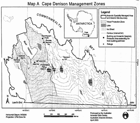
Cape Denison (ASMA No. 3) is a 1.5 kilometre wide peninsula stretching into the centre of Commonwealth Bay. Its topography is defined by a series of four rocky ridges running south-southeast to north-northwest and three valleys filled with ice, snow and glacial moraine. The largest, most westerly of these valleys contains the four Australasian Antarctic Expedition huts known as Mawson´s Huts. The Area covers four areas, each of which contains one timber hut and a five metre buffer zone extending from the perimeter of the hut. The huts are located at:
| Main Hut | 67°00-�31-�S | 142°39-�39-�E |
| Transit Hut | 67°00-�30-�S | 142°39-�42-�E |
| Absolute Magnetic Hut | 67°00-�23-�S | 142°39-�48-�E |
| Magnetograph House | 67°00-�21-�S | 142°39-�37-�E |
Map: ASPA No. 162: Mawson´s Huts
 View a larger version of this image
| RESTRICTED AREAS |
| Antarctic Specially Protected Area No. 163 |
| Dakshin Gangotri Glacier, Droning Maud Land |
| Lat: 70°44-�S; Long: 11°33-�30-�E (to 11°36-�E) |
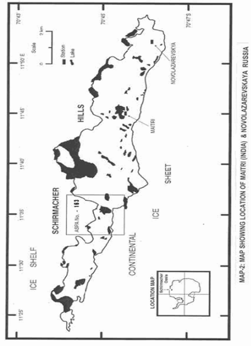
The Dakshin Gangotri Glacier is a small tongue of polar continental ice sheet, overriding the Schirmacher Oasis. The Area is 4.53 square kilometres and comprises four distinct topographical units - the southern continental ice sheet; rocky hill slopes; a vast central proglacial lake (Lake-B7, Sbrosovoye Lake); and northern undulatory shelf ice.
Map: ASPA No.163: Dakshin Glacier
 View a larger version of this image
| RESTRICTED AREAS |
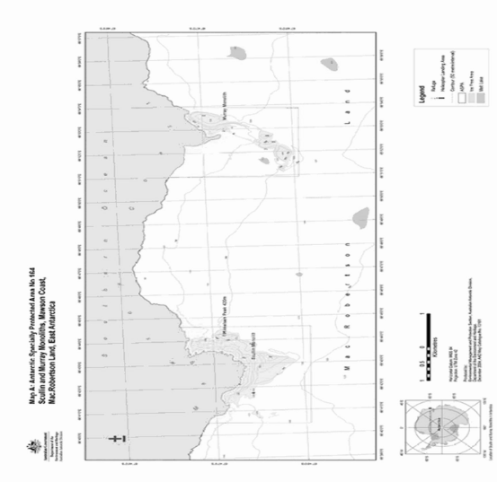
| Antarctic Specially Protected Area No. 164 |
| Scullin and Murray Monoliths, Mac Robertson Land, East Antarctica |
| Lat: 67°47-�S; long: 66°42-�E (Scullin); Lat: 67°47-�S; long 66°53-�E (Murray). |
The Area comprises two sectors - Scullin and Murray monoliths - which hold the greatest concentration of breeding sea bird colonies in East Antarctica. Situated on the coast of Mac Robertson Land they are approximately 7 kilometres apart and abut the sea at the edge of the continental ice sheet.
Map: ASPA No. 164: Scullin and Murray Monoliths
 View a larger version of this image
| RESTRICTED AREAS |
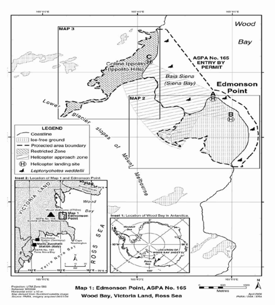
| Antarctic Specially Protected Area No. 165 |
| Edmonson Point, Wood Bay, Ross Sea |
| Lat: 74°20-�S; Long: 165°08-�E |
The Area comprises 5.49 square kilometres, including the entire ice-free ground of Edmonson Point, the separate ice-free area of Ippolito Hills and the nearshore marine environment and intervening sea of Sienna Bay. The margin of the permanent ice sheet extending from Mount Melbourne is defined as the boundary in the west, north and south of the Area. The eastern boundary is marine.
Map: ASPA No. 165: Edmonson Point
 View a larger version of this image
| RESTRICTED AREAS |
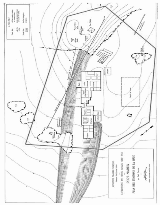
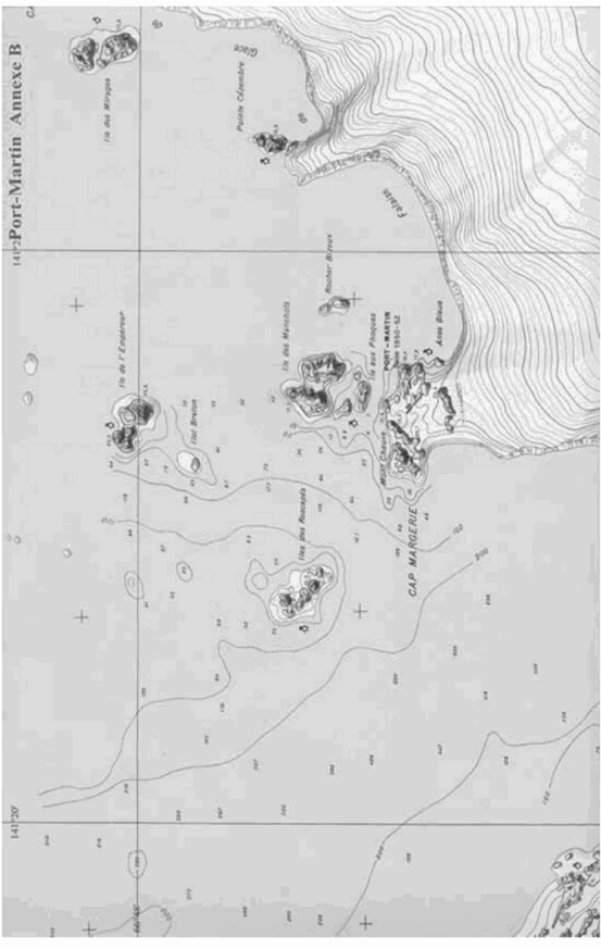
| Antarctic Specially Protected Area No. 166 |
| Port-Martin, Terre-Adélie |
| Lat: 66°49-�S; Long: 141°23-�E |
The Area comprises the Historic Site of Port-Martin (listed as Site Number 46 in Schedule 2) and the remaining ancillary buildings, including a shelter, weather shelter and coal and supply sheds, of the former French base at Port-Martin.
Map 1: ASPA No. 166: Port Martin
 View a larger version of this image
Map 2: ASPA No. 166: Port-Martin
 View a larger version of this image
| RESTRICTED AREAS |
| Antarctic Specially Protected Area No. 167 |
| Hawker Island, Vestfold Hills, Ingrid Christensen Coast, Princess Elizabeth Land, |
| East Antarctica |
| Lat: 68°35-�S; Long: 77°50-�E |
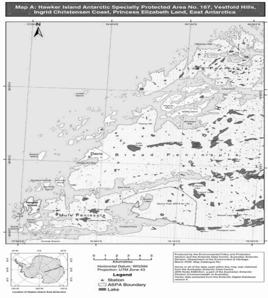
Hawker Island, which lies some 300 metres off the Antarctic mainland, is located 7 kilometres south-west from the Australian David station in the Vestfold Hills. It supports a breeding colony of southern giant petrels on the coast of continental Antarctica. It also supports colonies of Adelie penguins and other birds.
Map: ASPA No. 167 Hawker Island
 View a larger version of this image
Regulation 4(d)
| Site No | Description of Site | Latitude, Longitude |
|---|---|---|
| 77 | Cape Denison, Commonwealth Bay, George V Land, including Boat Harbour and the historic artefacts contained within its waters. Part of this Site is contained within ASPA No. 162. |
67°00-�S 142°39-�E |
| 78 | Memorial Plaque at India Point, Humboldt Mountains, Wohlthat Massif, central Dronning Maud Land. This plaque was erected in memory of three scientists of the Geological Survey of India and a communication technician from the Indian Navy who died in this mountain camp in an accident on 8 January 1990. |
71°45-�S 11°12-�E |
| 79 | Lillie Marleen Hut, Mt. Dockery, Everett Trange, Northern Victoria Land. Lillie Marleen Hut was erected to support the work of the German Antarctic Northern Victoria Land Expedition of 1979/1980 and is closely associated with the sinking of the expedition ship "Gotland II" in December 1981. |
71°12-�S 164°31-�E |
| 80 | Amundsen´s Tent | In the vicinity of 90°S |
The tent was erected at 90°S by the Norwegian group of explorers led by Roald Amundsen on their arrival at the South Pole on 14 December 1911. The tent is buried underneath the snow and ice in the vicinity of the South Pole. |
||
| 81 | Rocher du Débarquement, Terre-Adélie | 66°36-�S 140°03-�E |
Rocher du Débarquement (Landing Rock) is a small island where Admiral Dumont D´Urville and his crew landed on 21 January 1840. |
||
| 82 | Monument to the Antarctic Treaty and Plaque | 62°12-�S 58°57-�W |
| The Monument consists of twelve copper panels supporting a copper globe, and is located in a central position between the Frei, Bellinghausen and Escudero Bases at Fildes Peninsula, King George Island, South Shetland Islands. The Monument bears a plaque with the following inscription: | ||
| "This Historic Monument, dedicated to the signatories of the Antarctic Treaty, Washington D.C. 1959, is also a reminder of the legacy of the First and Second International Polar Year (1882-1883 and 1932-1933) and of the International Geographical Year (IGY: 1957-1958) which preceded the Antarctic Treaty and recalls the heritage of International Cooperation that led to the International Polar Year 2007-2008." |
(This note is not part of the Regulations)
The Regulations amend Regulation 4(2) of the Antarctic Regulations 1995 by deleting the requirement for the applicant to cause notice of the application to be published in the London Gazette, and replacing it with a new requirement for the Secretary of State to publish notice of it on the internet website of the Foreign and Commonwealth Office.
They also replace the requirement in Regulation 6(5) for notices of environmental evaluations to be published in the London Gazette with a new requirement for publication on the internet website of the Foreign and Commonwealth Office.
The Regulations amend Schedule 1 to the Antarctic Regulations 1995 by adding further restricted areas and by modifying the description and map of one restricted area, to give effect to Measure 2(2004) of the Twenty-seventh Antarctic Treaty Consultative Meeting (Cape Town 2004), Measure 2 (2005) and Measure 3 (2005) of the Twenty-eighth Antarctic Treaty Consultative Meeting (Stockholm, 2005) , Measure 1(2006) of the Twenty-ninth Antarctic Treaty Consultative Meeting (Edinburgh, 2006) and Measure 1 (2007) and Measure 2 (2007) of the Thirtieth Antarctic Treaty Consultative Meeting (New Delhi, 2007).
The Regulations amend Schedule 2 to the Antarctic Regulations 1995 by adding new historic sites and monuments and deleting others which no longer exist. This gives effect to Measure 3(2004) of the Twenty-seventh Antarctic Treaty Consultative Meeting, Measure 5 (2005) Twenty-eighth Antarctic Treaty Consultative Meeting, Measure 3 (2006) of the Twenty-ninth Antarctic Treaty Consultative Meeting and Measure 3 (2007) of the Thirtieth Antarctic Treaty Consultative Meeting.
The Measures adopted by the Twenty-seventh Antarctic Treaty Consultative Meeting (Capetown) 2004) are published in Miscellaneous No. 5(2006) Cm 6898.
The Measures adopted by the Twenty-eighth Antarctic Treaty Consultative Meeting (Stockholm, 2005) are published in Miscellaneous No. 6 (2007) Cm 7166.
The Measures adopted by the Twenty-ninth Antarctic Treaty Consultative Meeting (Edinburgh 2006) are published in Miscellaneous No. 7(2007) Cm 7167.
The Measures adopted by the Thirtieth Antarctic Treaty Consultative Meeting (New Delhi, 2007) are published in Miscellaneous No. 3 (2008) Cm 7441.
S.I. 1995/2741, S.I. 1998/1007, S.I. 2000/2147, S.I. 2002/2054, S.I. 2003/323 and S.I. 2004/2782 Back [3]